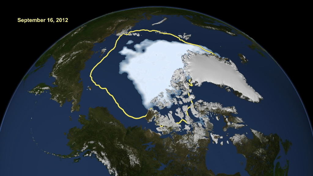
07. Alchemy Point of the AETHYR Element: The North Pole » NASA handout image shows the new record low Arctic sea ice extent
Shrinking Arctic Ice… all part of the master plan??
NASA handout image shows how satellite data reveals how the new record low Arctic sea ice extent, from September 16, 2012, compares to the average minimum extent over the past 30 years (in yellow). Sea ice extent maps are derived from data captured by the Scanning Multichannel Microwave Radiometer aboard NASA’s Nimbus-7 satellite and the Special Sensor Microwave Imager on multiple satellites from the Defense Meteorological Satellite Program. REUTERS/NASA/Goddard Scientific Visualization Studio/Handout (UNITED STATES – Tags: SCIENCE TECHNOLOGY ENVIRONMENT) FOR EDITORIAL USE ONLY. NOT FOR SALE FOR MARKETING OR ADVERTISING CAMPAIGNS. THIS IMAGE HAS BEEN SUPPLIED BY A THIRD PARTY. IT IS DISTRIBUTED, EXACTLY AS RECEIVED BY REUTERS, AS A SERVICE TO CLIENTS

Leave a Reply